
May 20th, 2026
Changelog (26.1.30)
New
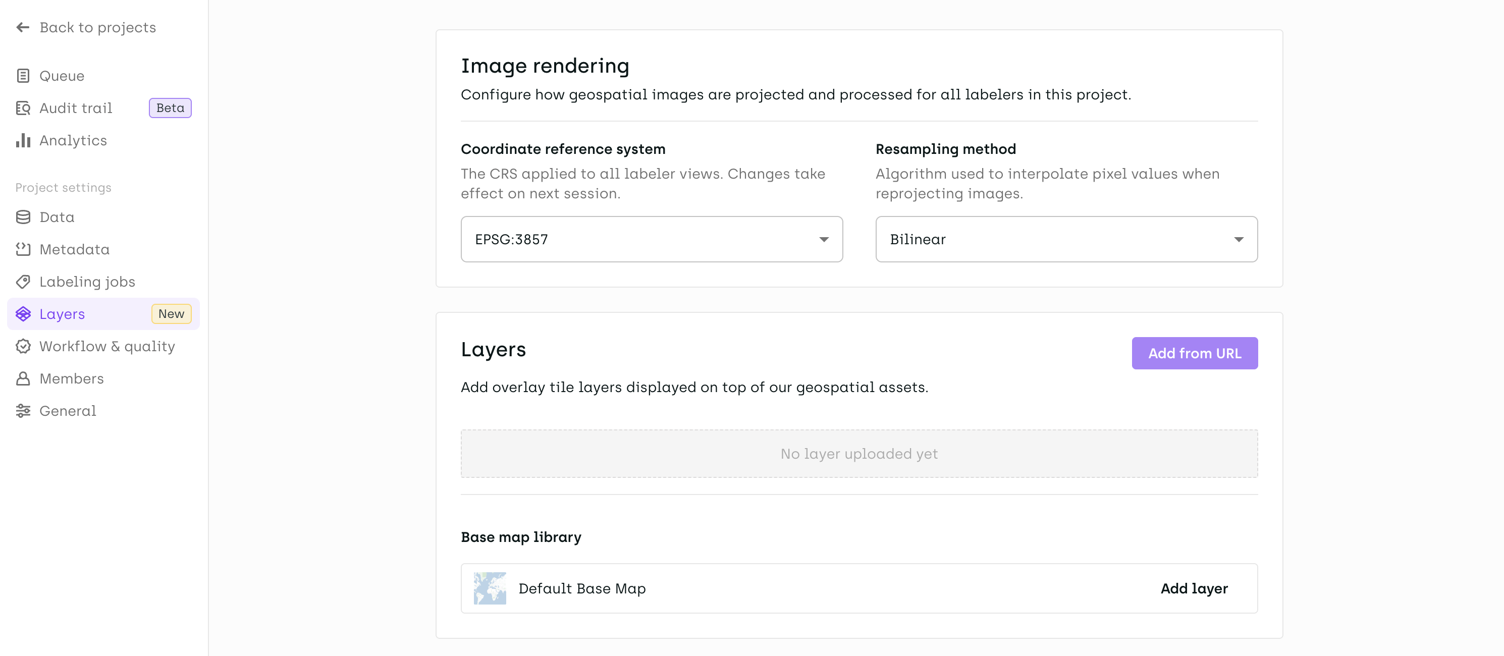
Geospatial: Project-Level CRS & Resampling Settings
Two new project-level rendering controls are now available in Project Settings under a dedicated Geospatial Rendering section:
- Coordinate Reference System (CRS): Admins can lock the CRS used for all edition operations across the project (
Original Image,EPSG:3857, orEPSG:4326). In edition mode, this setting is enforced for all members. In read-only mode, users can still change the CRS locally for visualization purposes. - Resampling Method: Admins can choose the image rendering algorithm applied uniformly across the project — Nearest Neighbor, Bilinear, Cubic, or Average. Learn more.
When a base map is enabled, the CRS is automatically set to EPSG:3857.
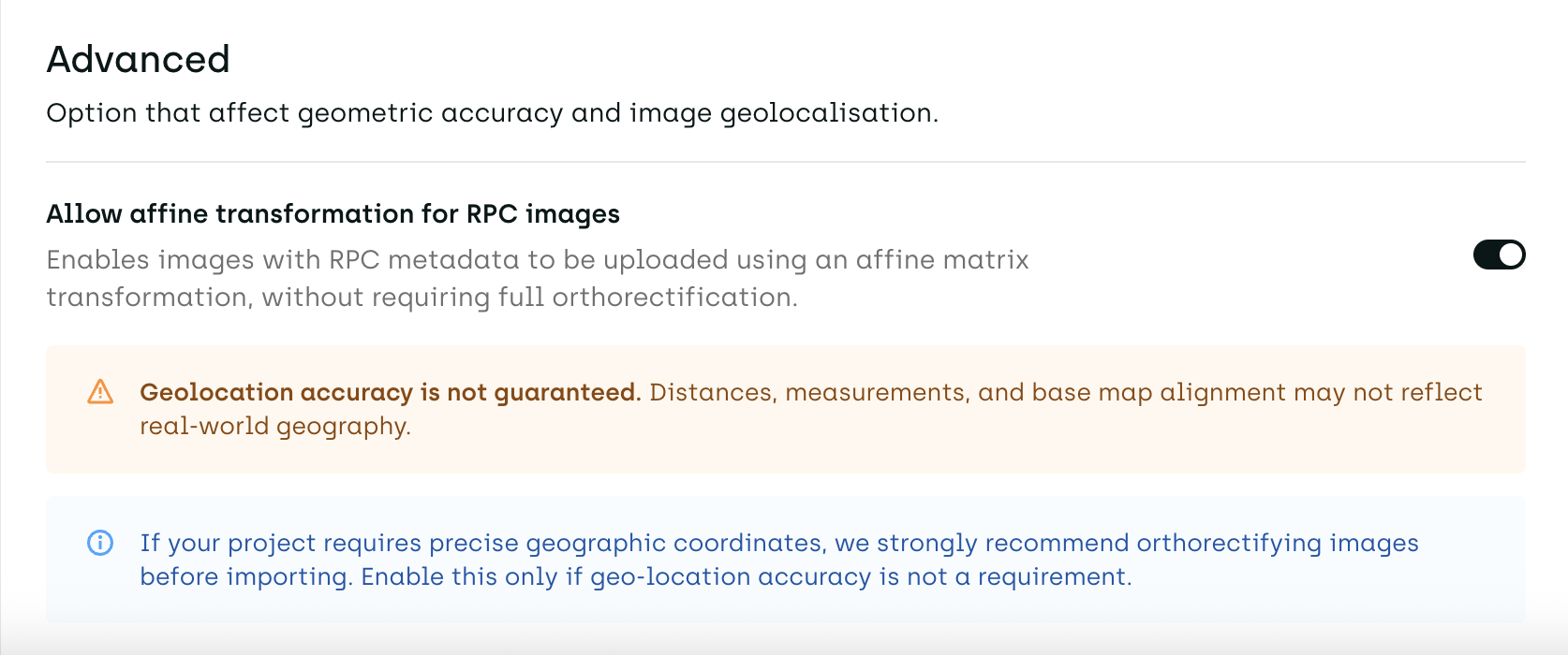
Geospatial: Affine Transformation Opt-In for RPC Images
Project admins can now choose to allow images with RPC (Rational Polynomial Coefficients) metadata to be imported using an Affine matrix transformation. This setting is off by default and gated behind an explicit warning, as it does not guarantee geo-location accuracy. When disabled, RPC images continue to be rejected at upload with a clear error message.
Copy-Paste Annotations on PDF
Multi-selection copy-paste is now supported on PDF assets. Select multiple objects at once and paste them within the same asset or across different assets.
OCR Autofill on PDF and Image Assets
OCR autofill for transcription fields now uses native text extraction by default on both PDF and image assets. You can still import your own OCR metadata if it is more relevant for your use case.
Change
Asset Import: Downloadable Error Report
When multiple assets fail to import in the same batch, all errors are now consolidated in the downloadable report, making it easier to identify and fix issues at scale.
Corporate Email Restriction for Organization Creation
Organization creation is now restricted to corporate email domains.
Consistent Status Names Across UI and Exports
Label status names are now identical in the labeling interface and in exported data. As part of this change, two statuses have been renamed: DOING is now IN_PROGRESS, and REDO is now REWORK. If you are using the old names in your scripts, a warning will prompt you to update them.
Fix
- Fixed resizing a bounding box between two keyframes while navigating in the video timeline.
- Fixed annotation names showing as "undefined" in video projects after a page refresh.
- Fixed the "Zoom to fit" button not scrolling to the correct annotation.
- Annotations can no longer be reshaped in read-only mode across Image, Video, and Geospatial projects.
- The paste context menu is now disabled while drawing or editing semantic shapes.
- The
Shift+1priority shortcut is no longer intercepted by the Map View in geospatial projects. - Fixed tile zoom levels when zooming with a mouse wheel or trackpad in geospatial projects.
- Fixed the
assetStep.namefield not being returned correctly in SDK queries.