
March 11th, 2026
5 months ago by Kili Technology
Changelog (26.1.26)
New
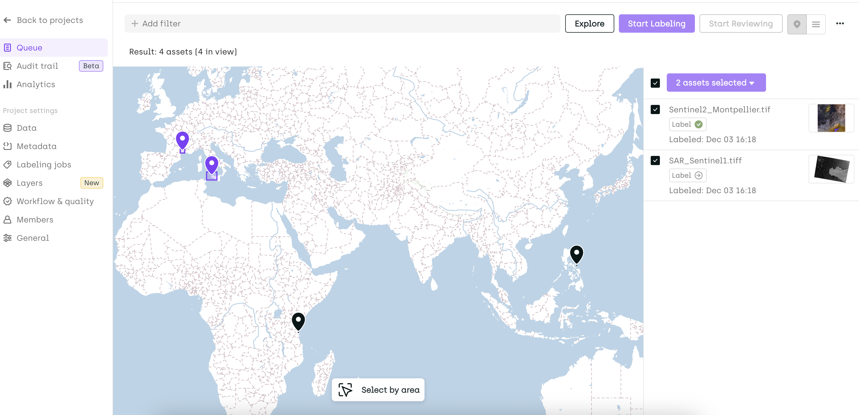
Early Access (Private Beta) – Map View in Geospatial Projects
Available upon request. Contact our support team to enable early access.
We are introducing the Map View for Geospatial Projects. This view allows you to visualize the geographic location of your assets directly on a map, select them spatially, and perform actions such as assignment or prioritization based on their location.
This feature also introduces a default base map that will be available in all Kili Geospatial projects.
Change
- [PDF] Drag Multiple Bounding Boxes - You can now move multiple bounding boxes at once in PDF projects. After selecting several bounding boxes, simply drag them to reposition the group within the document.
Fix
- Fixed an issue where an asset could move to an inconsistent status when a reviewer revised a label and sent it back for correction.