
June 4th, 2025
Changelog (v2.176.0)
New features available on Geospatial projects (Private Beta)
Geospatial projects are currently in Private Beta — contact our team to request access.
Cloud storage support
You can now connect a cloud bucket (AWS, Azure, or GCP) to your geospatial projects. GeoTIFF files stored in the bucket will be automatically synchronized and added as assets.
Note: Files must be in Cloud Optimized GeoTIFF (COG) format and use a supported CRS (EPSG:4326 or EPSG:3857).
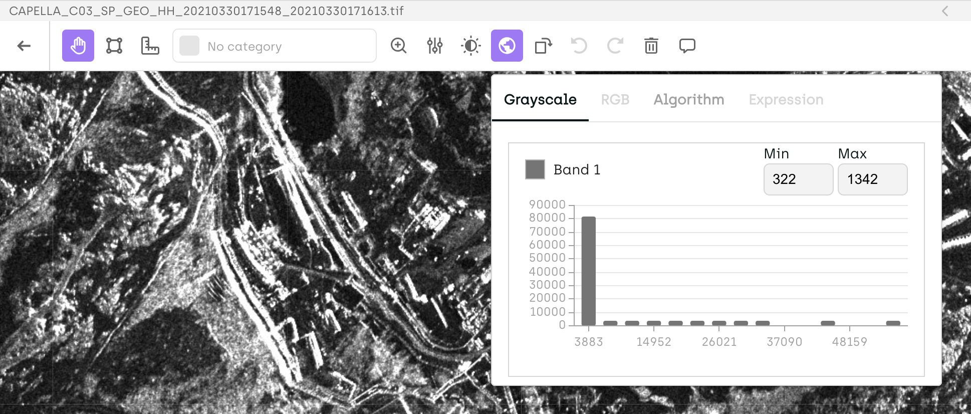
Default rescaling and histograms for geospatial images
Images not in UInt8 format are now automatically rescaled using the 2nd and 98th percentile of pixel values to improve visualization. Histograms are also available, showing the pixel value distribution for each selected band.
Find location by coordinates
Quickly locate a specific point in the image by right-clicking and selecting “Find location,” then entering latitude and longitude.
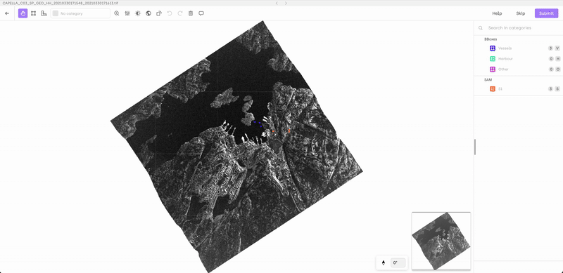
Interactive mini-map
Use the mini-map to navigate the image by dragging the viewport box. A smoother way to explore large scenes.
- Major performance improvements on huge labels
Support for huge labels
You can now edit extremely dense annotations—such as segmentation labels with over 10,000 objects—without performance issues.
New features available in the Multi-step workflow
Note: Multi-step workflow is currently in private beta and will be available to all users very soon.
Prioritize reviews
You can now assign priority levels to assets pending review—directly from the Project Queue in the Kili app or via the SDK.
Custom step names
Workflow steps can now be renamed to better reflect your team’s process, right from the workflow settings.
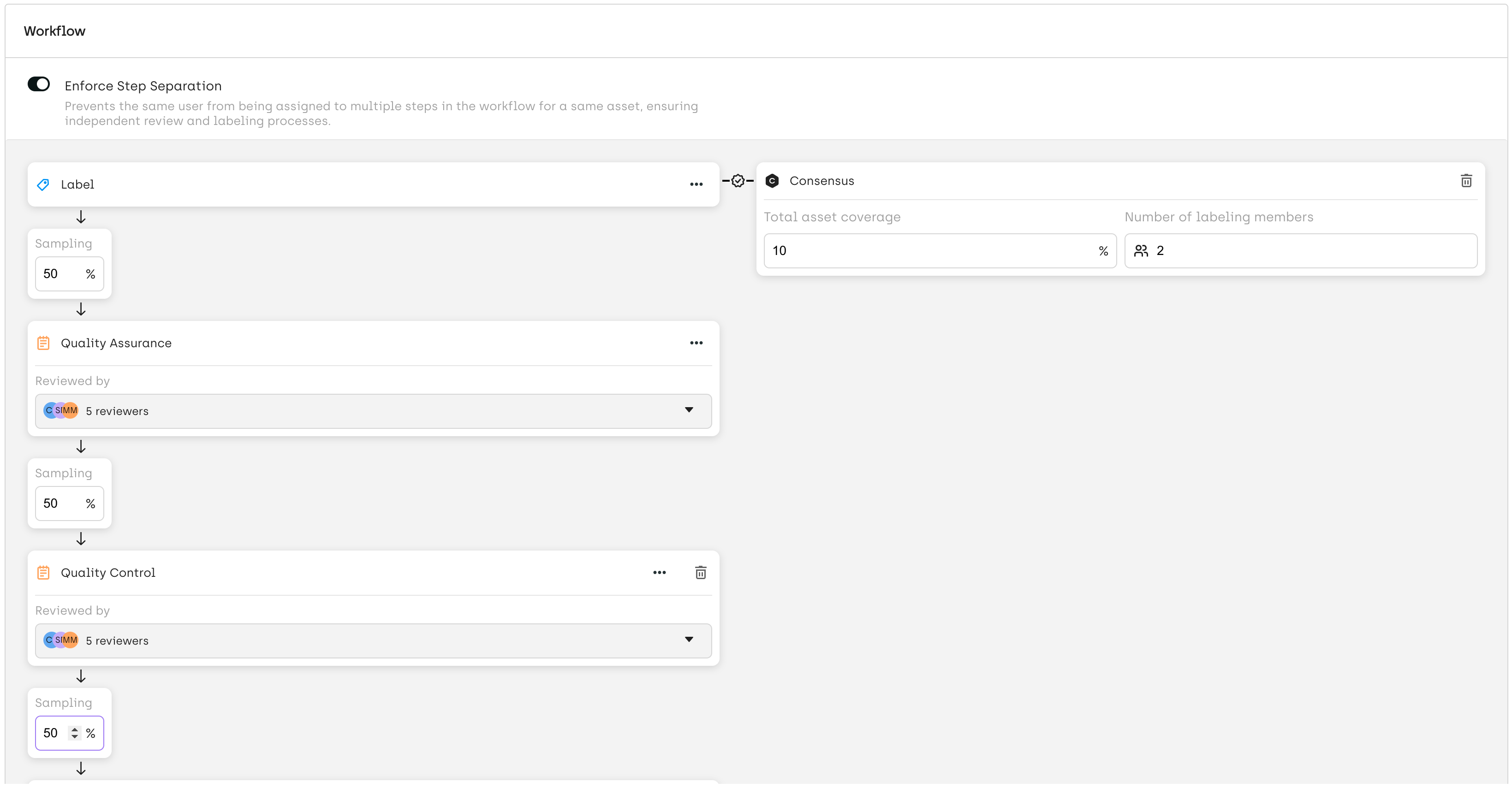
SDK support for label corrections in multi-step workflows
You can now correct a label on a specific step using the SDK. Simply use kili.append_labels and provide the step_name to apply the correction within the desired step of the workflow.
Other changes
- On the Queue page, Step and Status are now displayed in a single column for improved clarity and readability.
- You can now configure consensus directly from the workflow diagram.
Fix
- [Auto-assign in consensus mode] Resolved an issue where auto-assign didn’t work when consensus was enabled. Auto-assignment now functions correctly with consensus, except when specific members are already assigned to the asset.
- [Organization admins and project membership] Fixed an issue where organization admins weren’t recognized as project members, which caused side effects when adding them. Admins are now properly handled in project workflows.
- [Rendering order in Geospatial/Image interface] Fixed an issue where smaller objects (e.g., lines) were not displayed on top of larger ones (e.g., bounding boxes). The default rendering order now correctly ensures visibility of overlapping annotations.